Going Off Map: The Adventure of Discovery at Geology Field Camp!
By alexaeg | March 15, 2025
By Isaac E. Pope
At the core of every scientist and engineer is an explorer and investigator with some deeply imbedded personality to seek out what is unknown or unfixed and create some new conceptualization or contraption out of it. They spend years honing their craft, learning the intricate ways of their field. At some point or other, however, it comes time to leave the books behind and discover their field firsthand. In the life of a geologist, that time comes in the form of field camp, the opportunity to head off the maps of well tread territory to test their skills in the real world. For me, that occasion arrived this summer at the Colorado School of Mines in the form of a five-week adventure mapping geologic features across Colorado, Utah, and New Mexico.
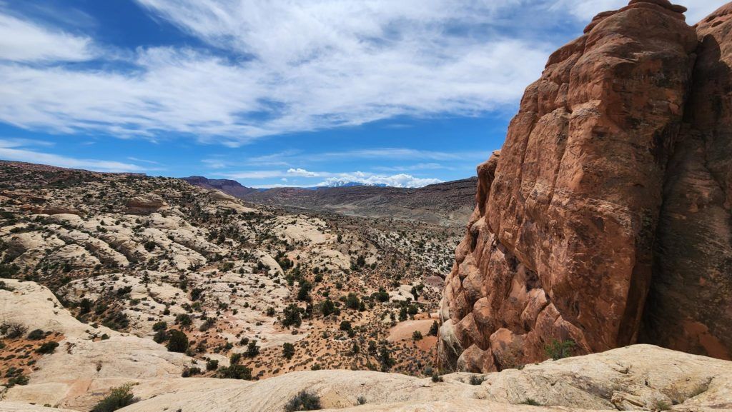
The adventure began in the wind-swept world of Arches National Park (figures 1 and 2). What many people do not realize about this place is that, overlooking its dry climate, this portion of Utah holds an uncanny number of similarities to the Gulf of Mexico. Although many people will picture the majestic spires and natural arches in the area, what hides far beneath the surface is a vast deposit of salt, and this salt is on the move (Trudgill et al., 2004). These salt deposits act a little like an air mattress after a long night of losing air – put your own weight disproportionately onto the mattress and before you know it you have sunk and the mattress is bulging all around you! In a similar manner, the salt is deeply buried beneath kilometers of sediment but, due to differential loading, the salt will deform in a ductile manner and gradually bulge in places. The sediments above these bulges of salt will then form these intricate systems of normal faults called relay ramps. It is in these environments that oil can be trapped, similar to the salt structures in the Gulf of Mexico which help trap oil so famously.
Like sages wandering the desert, we searched for clues. From our week of mapping, it became impressed upon us the importance of firsthand experience. We saw time and time again how it could be the smallest detail that could affect how complicated a model could be of oil migration. If you want to capture the real world in a computer model, after all, you have to get to know a slice of the real world firsthand. Sometimes those details come in unexpected ways; it may simply be centimeter-scale bedforms funneling fluid away from your expected target, or it could be that the surface features you see around you are formed not from the battling of distant plate margins but by the gradual movement or salt many kilometers beneath your feet.
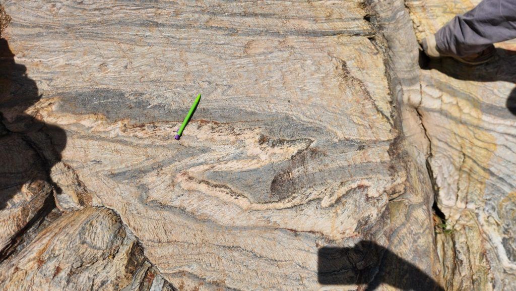
Of course, all good things must come to an end, but for us the journey was just beginning! For our second week, we migrated south to Sipapu in northern New Mexico to map the metamorphics in the Picuris Mountains (Bauer, 2004). There we saw the folding of metasedimentary units that made such twists and turns that looked as if they were made by a master of crafting (figure 3). As we mapped the many folds in the area, it began to dawn on us that perhaps mathematics does debut even in field geology. Much like fractals, folds on a sub-meter scale matched the morphology of those on tens of meters and, as our stereonets came together, matched even those on the tens of kilometers! Of course, as a scientists you are supposed to look at everything with a critical eye, but there are some days where we can have the joy of realizing just how well these textbook trends can work in the real world.
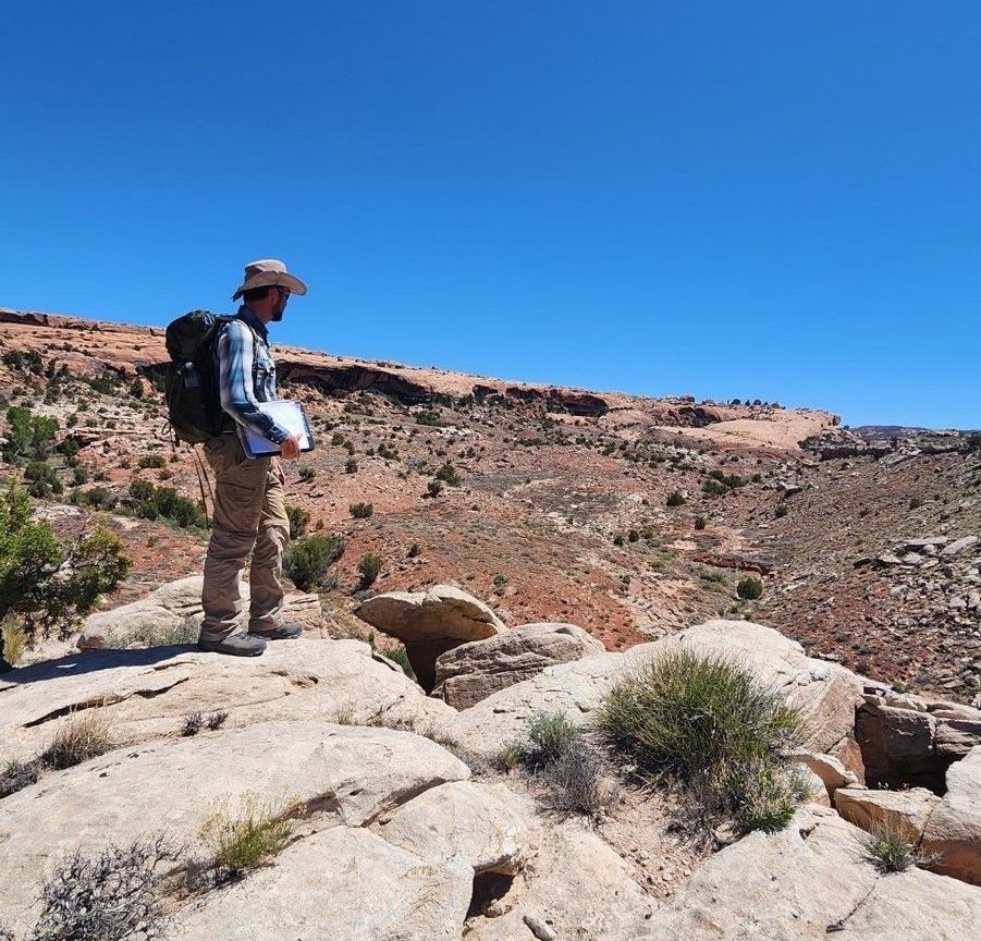
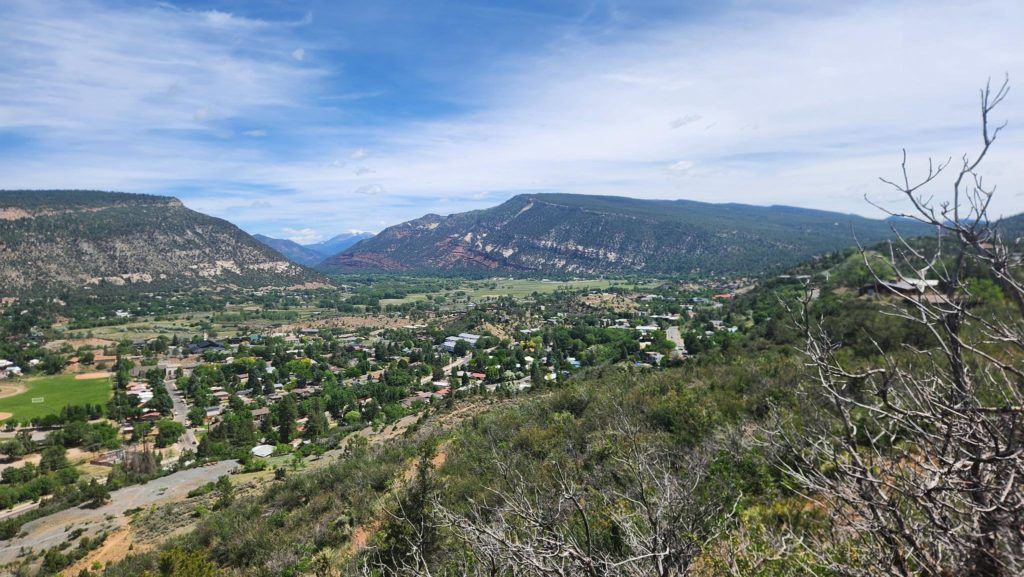
Structure was the order of week three as we headed deeper into New Mexico (figure 4). With the normal fault bound Sandia Mountains rising across the distant horizon, we studied the intricate tectonics north of Albuquerque where phases of both compression and extension had been overprinted time and again (Hart and Cooper, 2021). Our skills were further put to the test as we worked to unravel this tangle of threads of one long yet intricate story into Week 4 where, instead of unraveling the threads of tectonic regimes, we investigate the repeated advancement and recession of glaciers in southwest Colorado near Durango (figure 5). This week brought a fresh perspective of the uses of geologic mapping as we catalogued glacial deposits and assessed their value for aggregate mining in proposed construction projects. For many this offered a unique look at potential careers in geologic mapping. Even so, for someone who had many raised in a landscape of volcanoes, floods, and fire, the best was yet to come.
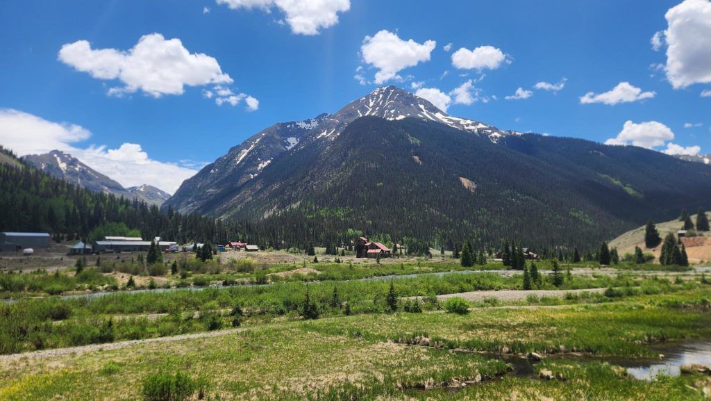
For the final week, the class split as some ventured off to mining exploration, while for myself and others we were bound to mapping the geologic hazards of Silverton high in the Colorado Rocky Mountains (figure 6). After focusing so long on the record of events that happened long ago, it was now time for our eyes to be opened to events that were unfolding before us in the present day. Debris flows, avalanches, acid mine drainage, where not to invest in real estate (alright, not quite but the implications are there!) and more were the practical applications as we put to use our understanding of geologic hazards to their interfacing with society.
When it was all said and done, we left field camp with far more than we had started. Those of us that went in as apprentices found ourselves coming out as novel masters ready to enhance and apply newfound skills. Everything we had learned in the classroom up to that point was put to the test, proving both the value and the limitations. It was empowering to leave, no longer simply students rummaging about in the dark, but as newly minted geologists equipped with the skills. I will be forever grateful for the legends who taught it and resources like the Beardsley-Kuper Geology Field Camp Scholarship for this opportunity of a lifetime.
References
Bauer, P.W., 2004, Proterozoic rocks of the Pilar Cliffs, Picuris Mountains, New Mexico, in Brister, B., Bauer, P.W., Read, A.S., Lueth, V.W., [eds.], Geology of the Taos Region, New Mexico Geological Society 55th Annual Fall Field Conference Guidebook, 440 p. doi: 10.56577/FFC-55.
Hart, B.S. and Cooper, S., 2021, Mechanical stratigraphy in Mesozoic rocks of the San Juan Basin: Integration of stratigraphic and structural terms and concepts, The Mountain Geologist, vol. 58, no. 2, doi: 10.31582/rmag.mg.58.2.159.
Trudgill, B.D., Banbury, N., Underhill, J., and Post, P.J., 2004, Salt evolution as a control on structural and stratigraphic systems: Northern Paradox foreland basin, southeast Utah, USA, in Post, P.J., Olson, D.L., Lyons, K.T., Palmes, S.L., Harrison, P.F., and Rosen, N.C., eds., Salt-Sediment Interactions and Hydrocarbon Prospectivity Concepts, Applications and Case Studies for the 21st Century: Gulf Coast Section SEPM (Society for Sedimentary Geology), Houston, Texas, December 5–8, Annual Bob F. Perkins Research Conference : SEPM (Society for Sedimentary Geology), v. 24, p. 669–700, doi.org: 10.5724/gcs.04.24.0669.
Posted in Uncategorized